


 Algeria
 Egypt
Egypt Israel
 Jordan
 Lebanon
 Libya
Libya Morocco
 Palestine *
 Syria *
 Tunisia
EU civil protection project holds risk assessment training in Beirut
May 24, 2016
Share on 


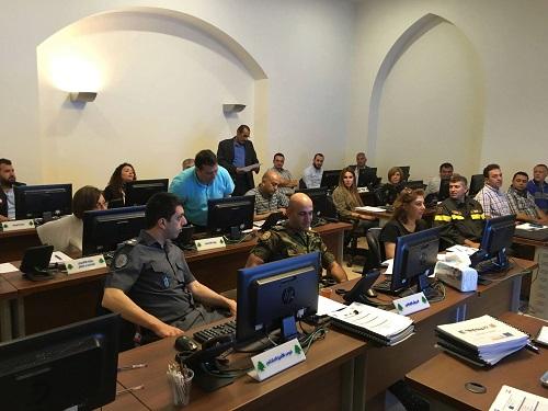
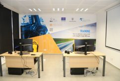
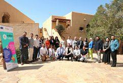
A four-day training workshop on Risk Assessment and Mapping with a focus on Geographic Information System (GIS) applications was held from 16 to 19 May 2016 in Beirut, Lebanon in the framework of the EU-funded PPRD SOUTH II (Prevention, Preparedness, and Response to natural and man-made Disasters) programme.
The workshop aimed at giving the participants representing key ministries, agencies and governorates a general overview of risk assessment and the usage of Geographic Information System (GIS). The first phase of the training, held in February, offered a theoretical approach by providing the necessary knowledge and skills for risk assessment. The second phase presented more practical and detailed information on risk assessment, and mapping including exercises and analysis, based on the background of the participants.
PPRD South II (Prevention, Preparedness, and Response to natural and man-made Disasters) is a three-year programme with a €5 million budget which aims at raising national resilience of southern Mediterranean partner countries (targeted by the European Neighbourhood Policy (ENP)) affected by a natural or man-made disaster, mainly through risk reduction (prevention, mitigation, public awareness) and preparedness (capacity building, contingency planning), including better cooperation at the international level. (EU Neighbourhood Info)
Read more
PPRD South II – fiche and news
PPRD South II website and Facebook page
Countries covered:
-
Lebanon
Related news